“I hope this tent is waterproof…” is not a musing you ever want to consider on a camping trip, but especially not when your company includes two small children under the age of five.
We had embarked upon our newly-minted annual Easter weekend family camping trip. After the successes of our inaugural trips last year with the whole family, we decided to venture out again for a Spring weekend trip before the unbearable heat of summer set in. Our destination was Tims Ford State Park, and this was no impulse trip. I’d been eyeing this park as our next camping destination for months, strategically picked a campsite, and spent way too much time Amazon-searching sleepwear for the toddler; my packing list considered every minor-to-major catastrophe; the weather forecast was in the clear. All in all, we were prepared.
And then an unexpected thunderstorm rolls in and you find yourself curled up in your sleeping bag as rain pours, thunder booms, and lightning flashes, hoping your tent doesn’t collapse, while simultaneously giving thanks that your children are still, inexplicably, sleeping through this.
Spoiler alert: the tent held up just fine; kids slept great; parents did not.


The park brochure boasts that Tims Ford Lake is “one of the most picturesque in Tennessee.” It’s tucked into the western valley of the Cumberland Plateau, formed by the damming of the Elk River – another one of the Tennessee Valley Authority’s innumerable projects.
When the TVA was established in 1933, one of its primary purposes was to bring cheap electricity to rural areas, idealistically to eliminate poverty throughout the valley. In the decades that followed, its projects were gargantuan in size and often used eminent domain to acquire the requisite land. The park’s Visitor Center offers a visual timeline of the creation of Tims Ford Dam, a project that launched in 1966. The area was home to several rural communities, including Marble Plains, Awalt, and Owl Hollow, that were uprooted when the reservoir began to fill; Awalt once sat at the bottom of a hollow that is now entirely under water.
The park attracts a flock of local outdoorsmen; it’s renowned for its bass fishing and offers permitted hunting on its grounds, a real rarity for a public park. There’s a golf course, marina, and extensive array of hiking and biking trails.


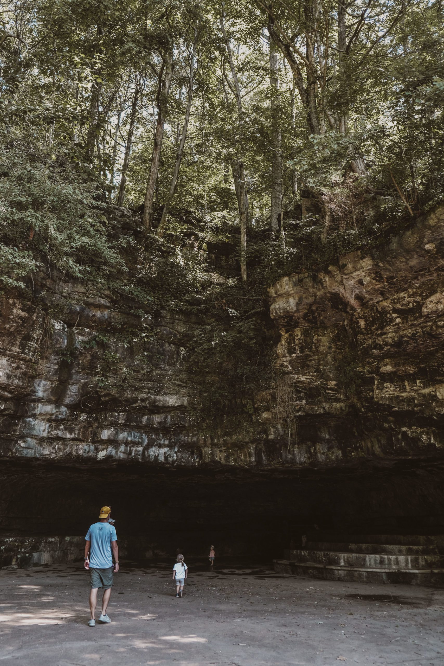
Upon recommendation of park employees, we opted for the well-traveled Lost Creek Overlook Trail that begins just behind the Visitor Center. This 1.35-mile one-way route hugs the ridge running along the lake’s shoreline before connecting to the 1.05-mile Marble Plains Loop Trail or the 1.1-mile paved Overlook Trail that heads back to the Visitor Center. Hikers will run across an old abandoned car that suffered a run-in with a tree before crossing a suspension bridge and heading downhill towards the lake’s edge. Ambitious adventurers can continue to the 3.3-mile Ray Branch Shoreline Trail and the 2.35-mile Evans Loop Trail, both of which are only accessible via earlier trails (or boat!). A backcountry campsite is available on the Evans Loop Trail, near the water’s edge.
Our party’s little legs seem to have shrunk even further as of late; hiking more than a mile, replete with pleas for snacks, complaints, and an intolerably slow place, has left me more deflated than fulfilled. Fortunately, of the main campground’s fifty campsites, ours (lucky 46) was located right next to the playground. For a more scenic distraction, the park’s 3-mile paved bike trail runs alongside the peninsular campground and leads to the Travis Hollow Bridge. It served as the perfect early morning leg stretch after emerging from our overnight rain shelter.


Considering the park is named after a lake, it would be negligent to visit without checking out the scenery at ground-level via the Lake View Marina. I thought we’d wrap up our visit with the half-mile Clifton Doyle Trail that winds along the shore next to the boat launch, but as I said – our little legs weren’t too eager. A brief reprieve at the end of the dock provided just the view we were looking for.
CHECKLIST:
Date: April 2022
Count: 18 of 56
GETTING THERE:
Tims Ford State Park is located 20 minutes south of Tullahoma in South Central Tennessee. Exit I-24 at Manchester for Highway TN-55 W. Follow for 13 miles until the street ends at Westside Drive/TN-130 S. Continue for 3.5 miles until a fork in the road; veer right onto Awalt and follow for 5.5 until it ends. Turn left onto Mansford Road. After 1.5 miles, the park entrance at Tims Ford Drive will be on the right.

Click here to read more of our adventures in Tennessee State Parks!