It was a quest for fall foliage. On a sunny, chilly Halloween morning, we headed east to Edgar Evins State Park, feeling confident the leaves at a higher elevation would be present and astounding.
Growing up, we spent many hot summer days on Center Hill Lake, my dad preferring its quiet, deep waters to those of the closer Percy Priest. It’s a tradition of my family that has dated back decades when my grandparents once owned a small lake house in the area and often visited with family and friends for days of lounging and fishing.
All those years and I never knew there was a state park on the lake’s shores.


Center Hill Dam was constructed in 1948 by the U.S. Army Corps of Engineers for the purpose of both flood control and electricity; the Caney Fork River (a tributary of the Cumberland, the region’s largest river which runs right through downtown Nashville) had a volatile history with frequent, destructive flooding prior to the dam’s construction. The resulting lake is one of four major flood control reservoirs for the Cumberland and, at its deepest, is 190 feet! The park’s namesake, James Edgar Evins, was a local businessman and state senator who was instrumental in the development of the dam and lake, which included recreational areas along the shores. Edgar Evins continued to push for the establishment of the state park in the area, which began construction in the 1960s and was officially dedicated in 1975.
On the October morning of our visit, there was a chill in the air, though the kind the sun would vanquish by midday. We began at the Visitor Center, high on a ridge of the Eastern Highland Rim. An observation deck accessible from the Visitor Center offers a panoramic view of the lake and surrounding hills, though with leaves on the trees, the view is mostly of green. The park boasts seven different hiking trails ranging in length from one-tenth of a mile to 5.35 miles. For our outing, we chose the Highland Rim Nature Trail, a supposed 1.35-mile loop that begins behind the Visitor Center.


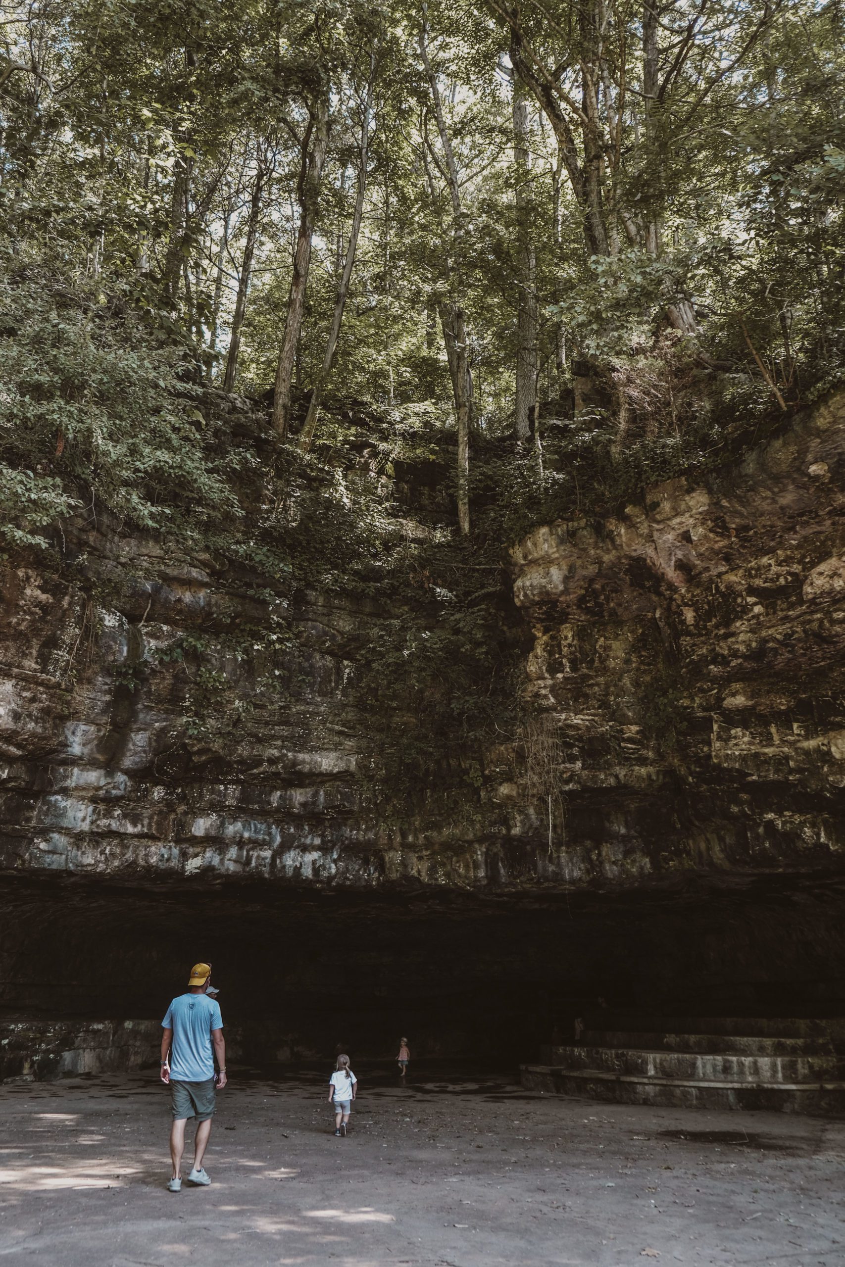
This was an exciting outing for us – it was our newborn’s first hike at just 2 weeks old. We were joined by a friend and fellow outdoors explorer who is a frequent companion on our adventures. The trailhead was easy to find but immediately had a contradiction; though the park map measures the Highland Rim Nature Trail loop at 1.35 miles, the trailhead sign states definitively “2 miles.” (I’m still confused about the discrepancy.) No matter, 2 miles was within our realm of possibility for the day, so we ventured on. The start of the trail is actually its highpoint, and as we hiked further down its path, we descended deeper into a forested gully.
And here is where I have to note: these forested views were entirely green; aside from some dry leaves on the ground, our quest for colorful fall foliage was a bust.
About a third of the way through the trail’s loop, you run along the lakeshore where a quick trek off the beaten path leads to a gorgeous view. There is ample space to explore and large, stable rocks to climb or sit for a rest. The vista was astounding, with an unbeatable blue sky above and the warm sun basking down; we snacked and skipped rocks for the most enjoyable interlude of this hike! The remainder of the trail climbs back up the ridge, zag-zagging through switchbacks when necessary, though it never feels too strenuous. As we slowly climbed, we hunted trail markers on trees, a game our friend began with our eldest on hikes we shared over a year ago, and gazed at the sun filtering through thinning trees. The trail’s end opens to the driveway looping behind the Visitor Center, back on high ground.
These first points of interest are at the very tip top of the park, right at its entrance. Follow the road, though, to head down the ridge to additional trails, the campground, picnic shelters, cabins, boat ramps, a restaurant, and marina. I have probably been to this marina and restaurant at some point in my life, unaware it was state park property; unfortunately, on this late fall day, the restaurant was closed and we had to find new lunch plans. I can’t wait to visit again in the summer and inevitably realize I’ve visited before!


CHECKLIST:
Date: October 2020
Count: 10 of 56
Must-See: Take in a view from the Observation Deck at the Visitor Center; venture down to the lakeshore, whether by hike, road, or boat.
GETTING THERE:
Edgar Evins State Park is located off I-40, sixty miles east of Nashville. Heading on I-40 E from Nashville, take exit 268 to TN Highway 96, exiting right towards Buffalo Valley Road. Follow TN-96 for about 3.5 miles to the intersection of TN-141. Continue straight onto TN-96, following park signs. Now you’re in the park and the road changes name to Edgar Evins State Park Road; continue to the Visitor Center, which will be on the right.

Click here to read more of our adventures in Tennessee State Parks!